A Plan Comes Together

December 2015: Canadian Geographic

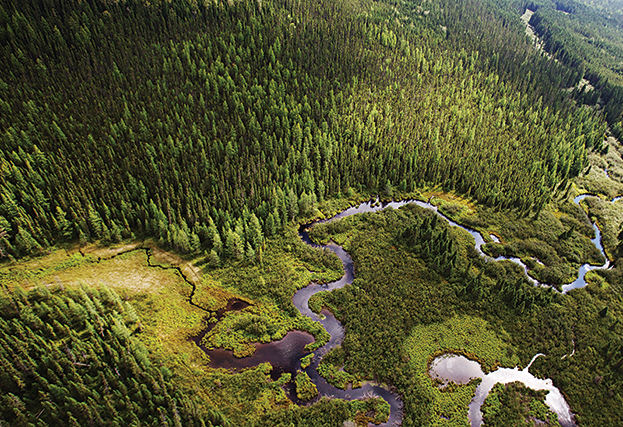
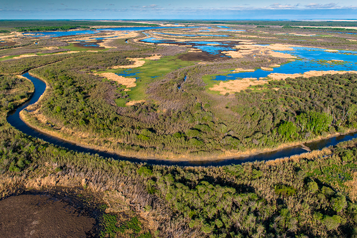
After flowing some 1,200 kilometres from Canada’s Rocky Mountains, collecting runoff from the Prairies and Boreal Plains, the Saskatchewan River spills into a maze of channels that cut across the low-lying forests and wetlands of the Saskatchewan River Delta.

At 10,000 hectares, it’s the largest inland delta in North America, and prime habitat for diverse wildlife, including one of the continent’s most important regions for migratory birds. It’s also part of Canada’s vast boreal forest, an ecosystem that stretches across the continent and soaks up so much carbon emissions it’s been called the northern lungs of the planet.

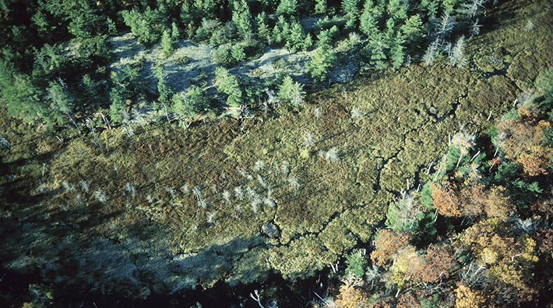
The delta and surrounding region in eastern Saskatchewan is one of several priority planning areas for the Canadian Boreal Forest Agreement (CBFA)—an ambitious pact signed in 2010 by six environmental groups and 18 forestry companies, the latter all members of the Forest Products Association of Canada.

Read the full story

Boreal Truce

January/February 2014: Canadian Geographic

Poised to deliver big results, the nearly four-year-old Canadian Boreal Forest Agreement continues to rely on the co-operation of former foes.

At the Radisson Hotel’s 12 resto bar in downtown Winnipeg, a collection of foresters, environmentalists, scientists and First Nations representatives huddle around a long table and shake off the early October chill. Seated together, they couldn’t be a truer reflection of the Canadian wilderness — equal parts “hewers of wood” and tree hugger, conservation biologist and northern hunter.

Read the rest of this story at canadiangeographic.ca

Seeing the Forest for the Trees

February 2014: Canada Foundation for Innovation (online)

A framework developed at the University of Alberta is helping the forest planners behind the world’s largest conservation agreement see the bigger picture.

In Canada’s boreal forest, a vast landscape that stretches from Newfoundland to the Yukon, woodland caribou and other iconic species live in an environment which alternates between frozen terrain and soppy ground that’s been known to sink heavy forestry equipment with ease.

The region’s wildlife thrives in large, undisturbed forest tracts. And although the boreal forest may seem endless, industrial excursions in the North have left scars, dividing contiguous landscapes with roads and pipelines and disrupting the region’s natural ecology.

Read the rest of this story at innovation.ca

An i-Tree for Everyone

Photo: flickr\René Ehrhardt

January/February 2011: Canadian Geographic

New software reveals what urban trees do for our cities.

At a suburban house outside Toronto, armed with assorted gadgets for measuring trees, I politely ask the homeowner whether I can assess the vegetation in part of his backyard. “My tax dollars put to good use,” he says sarcastically.

I’m working on a project to evaluate the state of the urban forest throughout the Greater Toronto Area, I explain, but attempting to ease his skepticism is futile. Thankfully, as my partner and I follow aerial maps to chase down plots throughout Brampton, Ont., another team is roaming the streets of Toronto, collecting data from over 400 random samples.

Read the rest of this story at canadiangeographic.ca


50 Million Trees

June 2010: Canadian Geographic

Ontario’s government has an ambitious plan to reforest the most populated part of Canada. First, it must grapple with libertarian landowners and fragmented landscapes — and the fact that it got out of the business of planting trees.

Along the back roads of eastern Ontario, among the sleepy towns, antique shops and touristy locks that squeeze the Rideau River south of Ottawa, “Back Off Government” signs pepper a mixed countryside of cattle farms and small woodlands. Landowner pride runs strong here, although many traditional farms have given way to properties bought up by transplanted urbanites escaping the city and relishing the natural scenery.

Read the rest of this story at canadiangeographic.ca